New technology a tool to predict and mitigate farm threats

Most marine aquaculture systems are exposed to the natural environment, which in turn subjects farm animals to a raft of potential threats. In addition to constant contact with parasites, bacteria and viruses, they’re also sitting ducks for environmental challenges like severe weather events, fluctuating water temperatures and salinity levels, oil spills and harmful algal blooms (HABs). Depending on their severity, such incidents can hit farming operations hard, perhaps even financially crippling them.
To keep an eye on their stocks, many producers have invested in expensive in-situ sensors that stream live data to farm managers. Though accurate, these sensors only provide information on their immediate surrounding area – usually a diameter less than 20 meters. With the greatest value to be gained from knowing what’s on the horizon rather than what’s on the doorstep, another approach is using old generation satellites to create maps of risk, although to date these have been low resolution and not tailored to the specific needs of fish farming.
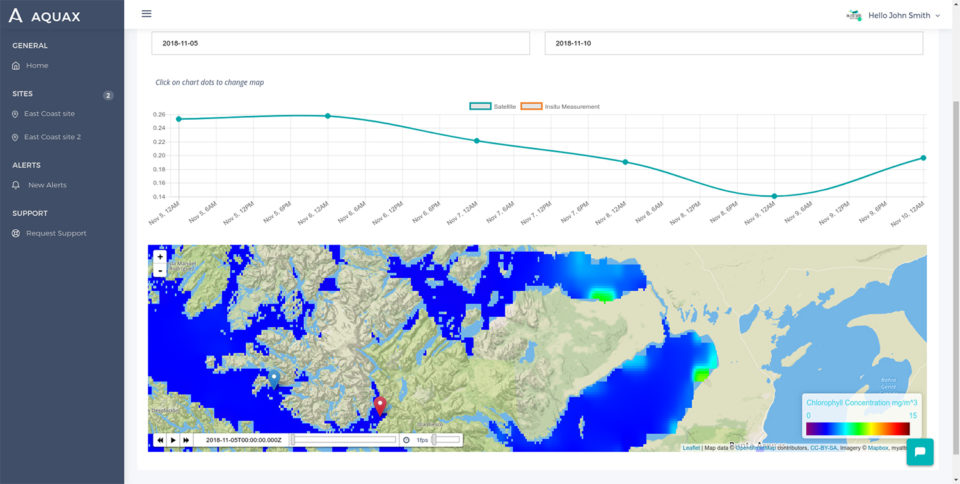
One start-up company looking to address these shortcomings is Verona, Italy-based ColomboSky. Its new AquaX satellite monitoring tool is based upon providing early detection and warning of approaching water threats specifically for marine aquaculture. It does this by integrating satellite data with in-situ water samples and mathematical models to both see very wide areas and be able to measure with very high accuracy what’s in the water.
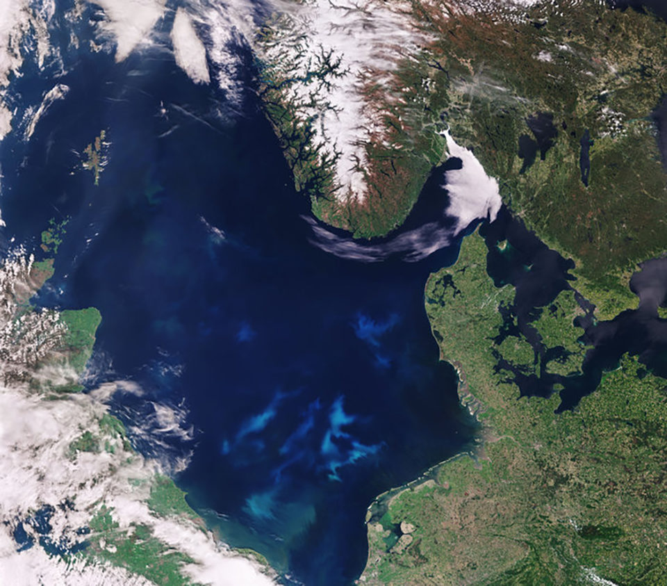
The satellite data used by AquaX is provided through its part-funder, the European Space Agency (ESA), and its Earth observation program Copernicus and its family of new generation Sentinel satellites. Depending on location, the result is a five- to seven-day window to putcontingency measures in place before a farming site is compromised.
“The aquaculture sector is not really capable at the moment to have a complete understanding of the environment in which it’s farming its fish,” said Simone Campara, co-founder of ColomboSky. “While it’s very difficult to estimate this current level of industry inefficiency, the production and profit losses through water quality alone run into billions of dollars.
“AquaX will enable producers to be proactive in dealing with the environmental issues that they are going to face. I think that’s the real change up – the shift from passively acting to proactively acting.”

Making a difference
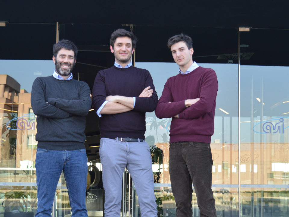
Campara and fellow co-founders Thomas Moranduzzo and Davide Castelletti, met some 10 years ago at university. This trio are all telecommunication engineers, specializing in the computing of satellite images. AquaX was born out of their ambition to use this expertise to build something of their own that could be used to have “the biggest impact on the health of the planet.”
They soon realized that oceans should be the focal point for any such undertaking; being, he said, “an index for the good-standing of the planet itself.”
Next, they started looking at different problems affecting the various industries related to the ocean. Again, it quickly became apparent that the most meaningful contribution they could make with their products was on the aquaculture market, and in particular creating an index for detecting harmful algal blooms (HABs).
“Algal blooms are a huge problem, but with some help you can save thousands of fish every month – thanks to advice that arrives a few days earlier. We have already validated this solution with many different companies and they like it. They have had many different problems just related to algal blooms, and to make things more complicated, it’s happening randomly. They have problems on the site, they also have mortality problems during the movement of fish from the production site to the processing plant in the wellboats. But the satellites can also find the best route for these vessels,” he said.
“For us, as an innovative start-up, we needed the project to be sustainable and we also needed to find a market that was interesting for us. Knowing that these companies are losing millions in profits every year, really caught our imagination. With satellites, you have a much better understanding of what’s happening in the bay, in the fjord and in other coastal areas than you do with in-situ sensors. Thanks to satellites, you can forecast what’s going to happen tomorrow or next week. That’s something you can’t get close to doing with sensors. Indeed, we haven’t found any companies that are trying to arrange forecasts with their sensors. It’s simply not feasible. We found a market, we found a problem and we found a solution. We did all of our homework and then we really started pushing to get the best product ready for the market.”
By combining different parameters and indexes, ColomboSky can detect different challenges from “simple” chlorophyll anomalies over a period of time to much more complex events like jellyfish blooms. Indeed, thanks to a contract with French non-profit ocean forecaster Mercator Ocean within the Copernicus User Uptake Program, the R&D has been expanded to address the big problem of jellyfish – faced by aquaculture and other marine sectors – with new product JellyX.
ColomboSky is now looking for private companies, associations and public institutions interested in running pilot projects to test this latest solution.
“There are many different risk indexes that we can build from the information extracted from satellite images. It’s another level of monitoring and cautiousness with regards to what’s in the water.”
Charges levied depend on the size of the areas being monitored, the number or parameters and risk indexes activated, and whether or not the forecasting tool is required. Customer data and analysis can also be integrated into the package.

Going to market
ColomboSky has now completed its first year of incubation according to a business program created by ESA. This initiative also validated its business model.
The past year has also been spent conducting pilot projects in Chile, the Mediterranean Sea and Mauritius, and further trials are about to take place in Scotland and Panama.
Campara explained that the sophisticated satellite system means that with “a bit of algorithm tweaking,” valuable data can be sourced from any region around the world. For companies wanting to initiate a pilot and to start receiving data also takes less than 30 minutes. They merely provide ColomboSky with the coordinates and the parameters that they want to activate.
“In one click we can also go back in time by 20 years, which is interesting for such areas as sustainability certification audits. In the case of Friend of the Sea, for example, companies are required to monitor the water in a specific way for two years. We can provide these parameters for every week, month or in any format that they need it in. I guess that means we are scalable in time as well as geographically.”
However, with the exception of “a few, special companies” that might represent interesting new case studies, ColomboSky wants to close the testing phase of AquaX and embark on a full commercial roll-out in 2019. And while aquaculture is the main focus, Campara revealed that the longer-term vision is to be the go-to water quality monitoring platform for all marine sectors.
Core tools can be applied to a number of other industries, he said. For example, its new jellyfish matrix could also be an important resource for tourism sectors in regions like the Mediterranean where warmer waters and the widening of the Suez Canal in Egypt have resulted in unprecedented jellyfish numbers – native and alien species – impacting many different businesses.
“Our aim with AquaX is to become the Google Analytics tool for marine aquaculture but then we want to expand this capability to every possible market related to the sea and the oceans,” he said.
Follow the Advocate on Twitter @GAA_Advocate
Author
-

Jason Holland
Jason Holland is a London-based writer for the international seafood, aquaculture and fisheries sectors. Jason has accrued more than 25 years’ experience as a B2B journalist, editor and communications consultant – a career that has taken him all over the world. He believes he found his true professional calling in 2004 when he started documenting the many facets of the international seafood industry, and particularly those enterprises and individuals bringing change to it.
Tagged With
Related Posts

Innovation & Investment
Eye in the sky: Europe employs satellites to advance aquaculture
Copernicus – the European Space Agency’s €4.3 billion Earth Observation System – holds potential benefits for fisheries and aquaculture. The SAFI project is approaching the aquaculture sector about harnessing, and montetizing, this unique service from up above.

Responsibility
Can aquaculture flourish in a more symbiotic sea?
The 18-month Maribe project has uncovered some promising ideas for promoting growth and jobs within the blue economy. Aquaculture, fingered as one of five key areas for growth, could benefit from collaboration with renewable energies.

Intelligence
‘Spatiotemporal patterns’ indicate improving perceptions of aquaculture
A study led by University of California Santa Barbara researchers has found that public sentiment toward aquaculture improves over time, a potentially important development with growing interest in offshore aquaculture.

Innovation & Investment
Fish behavior-tracking tech aims to curb aquafeed wastage
Overfeeding is a waste stream for aquaculture. Underwater cameras in pens help, but a company mixing hydroacoustics and machine learning has another idea.

